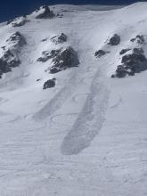

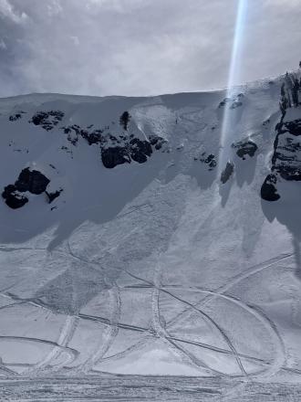
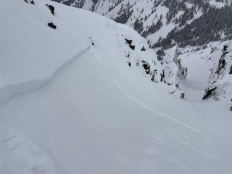
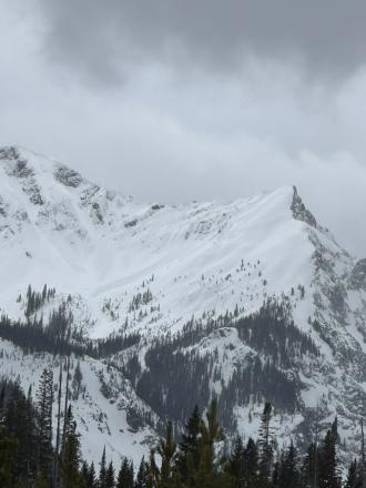
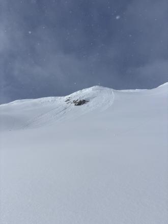
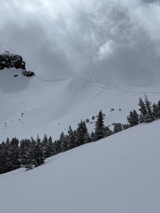
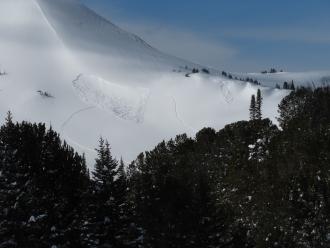
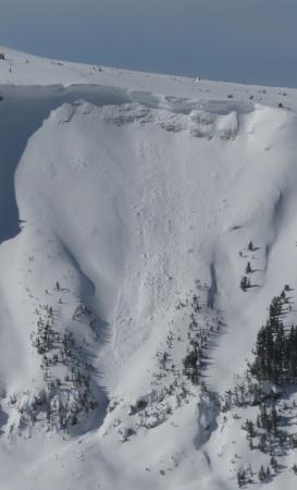
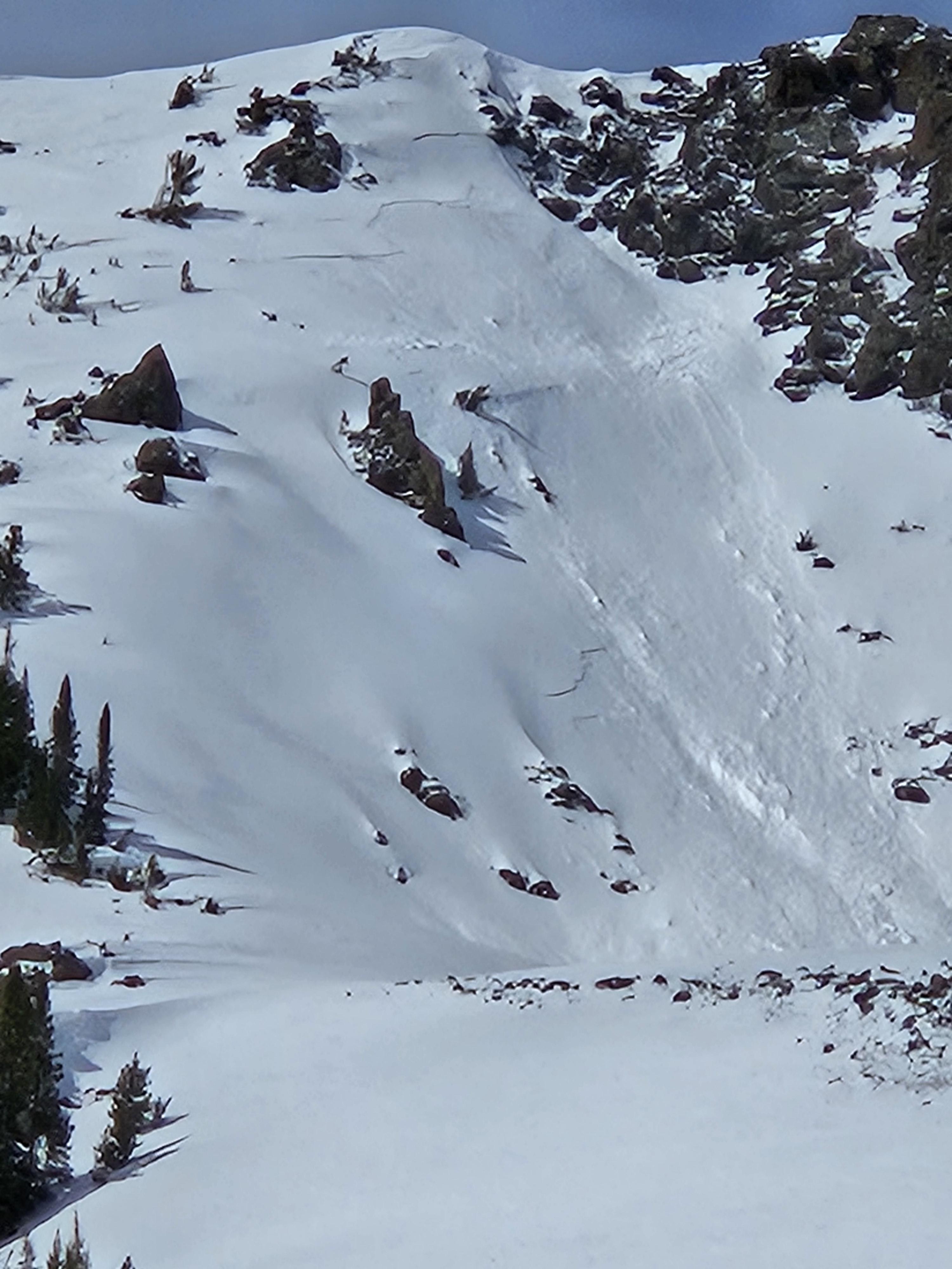
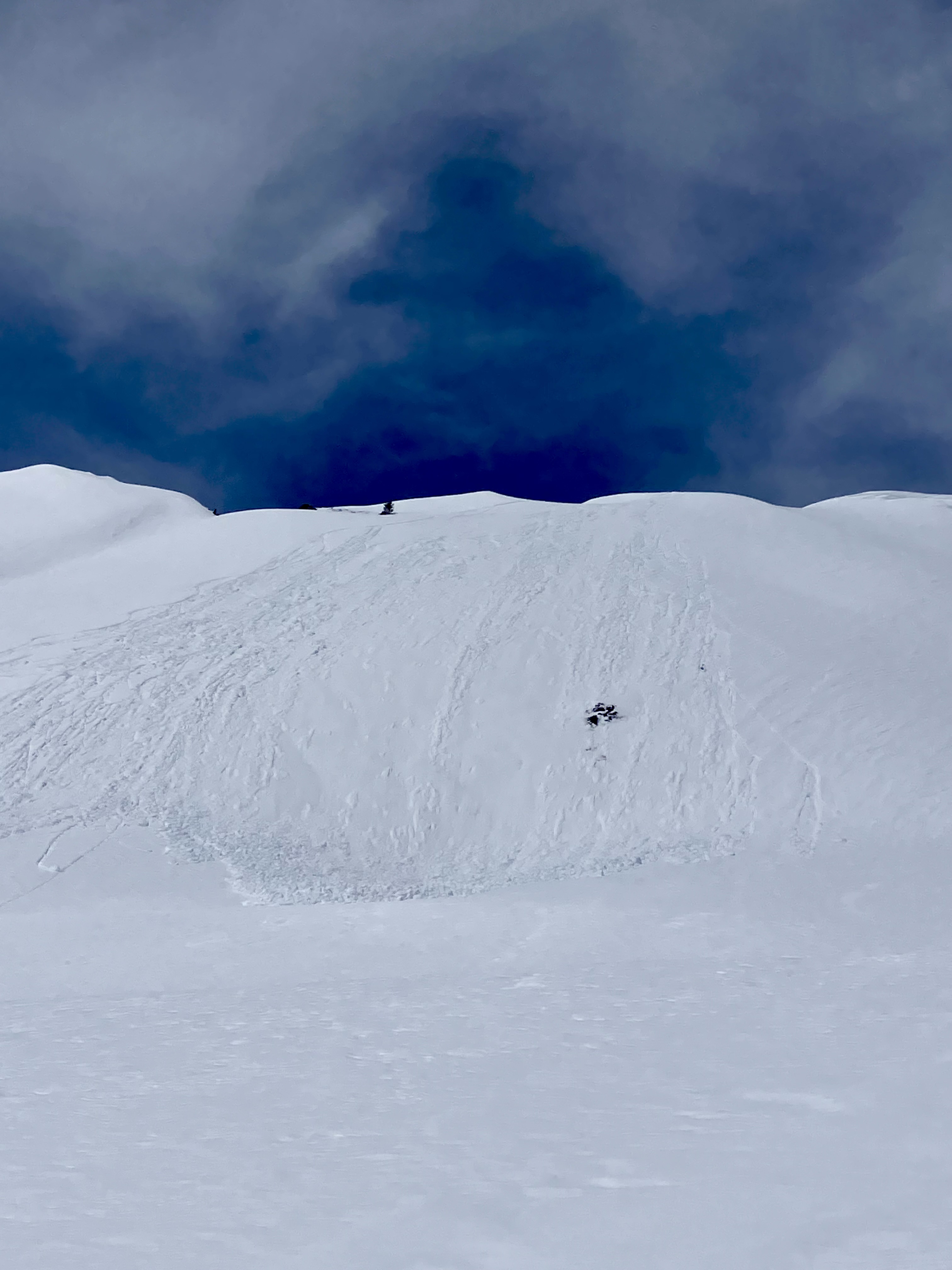
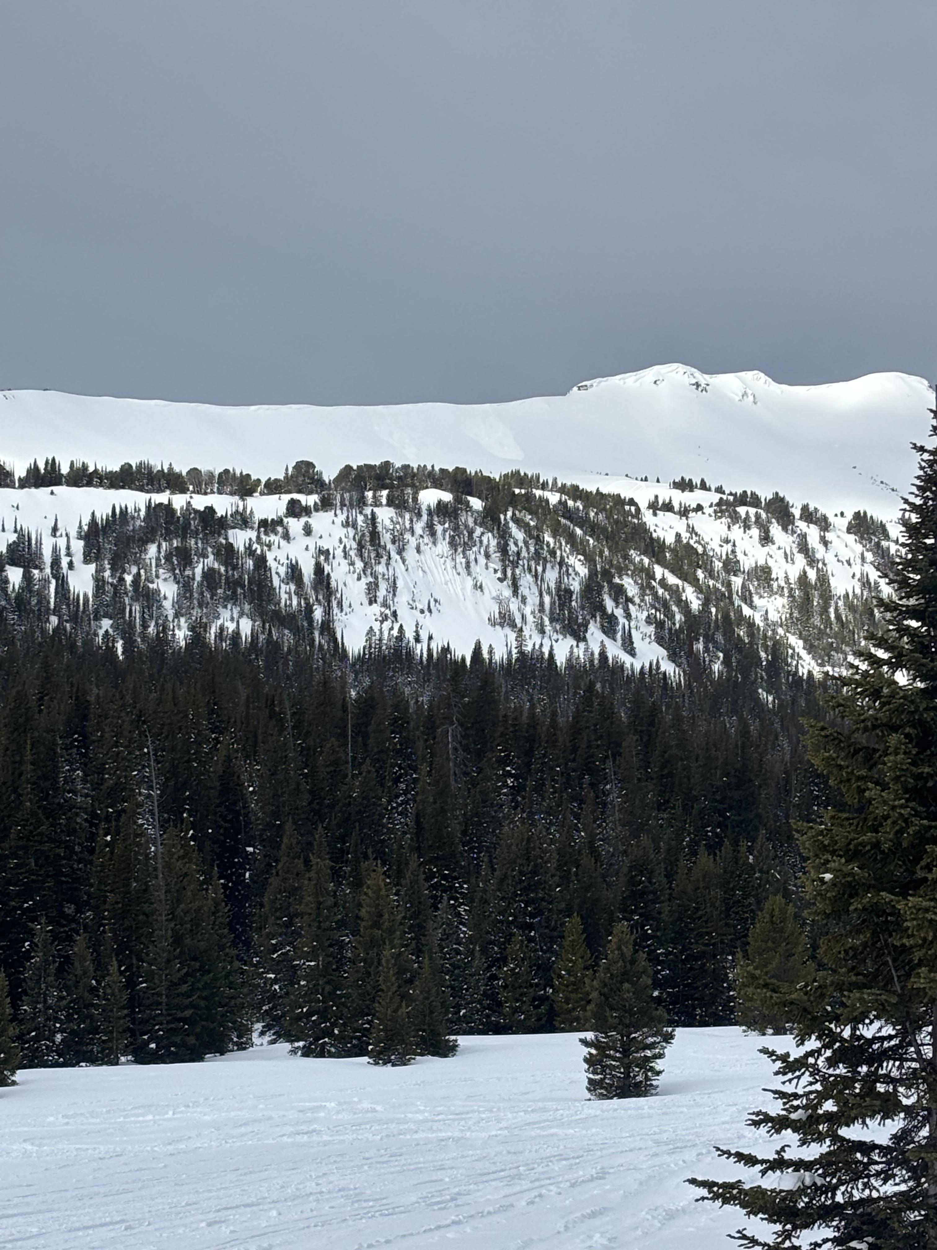
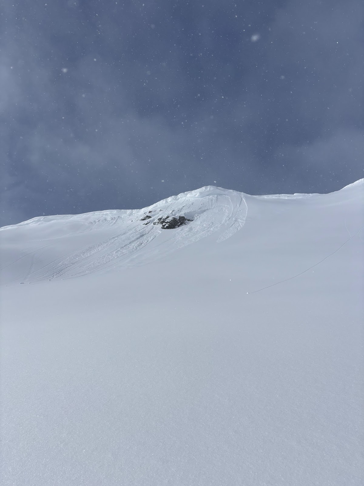
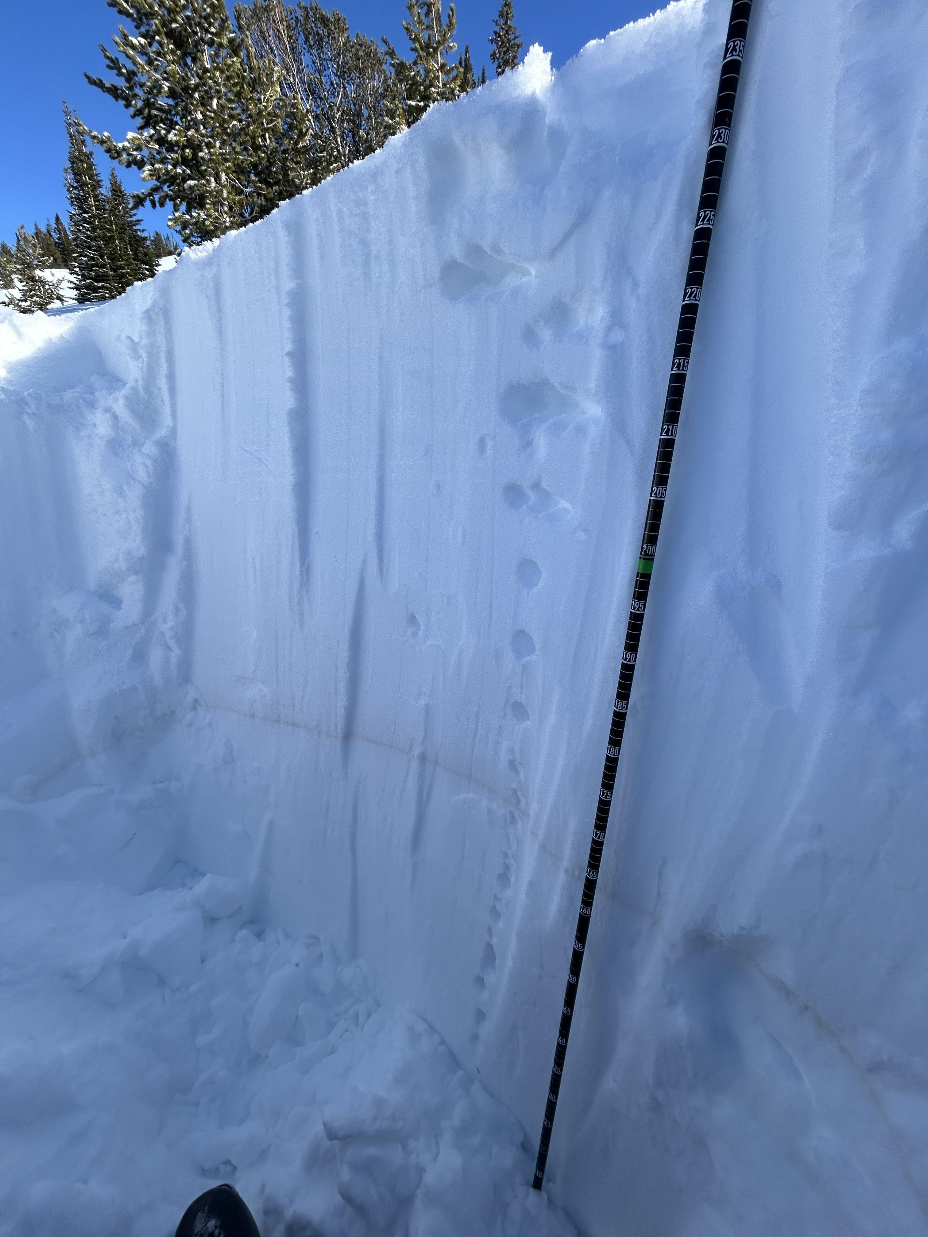
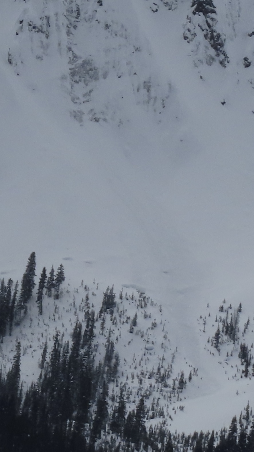
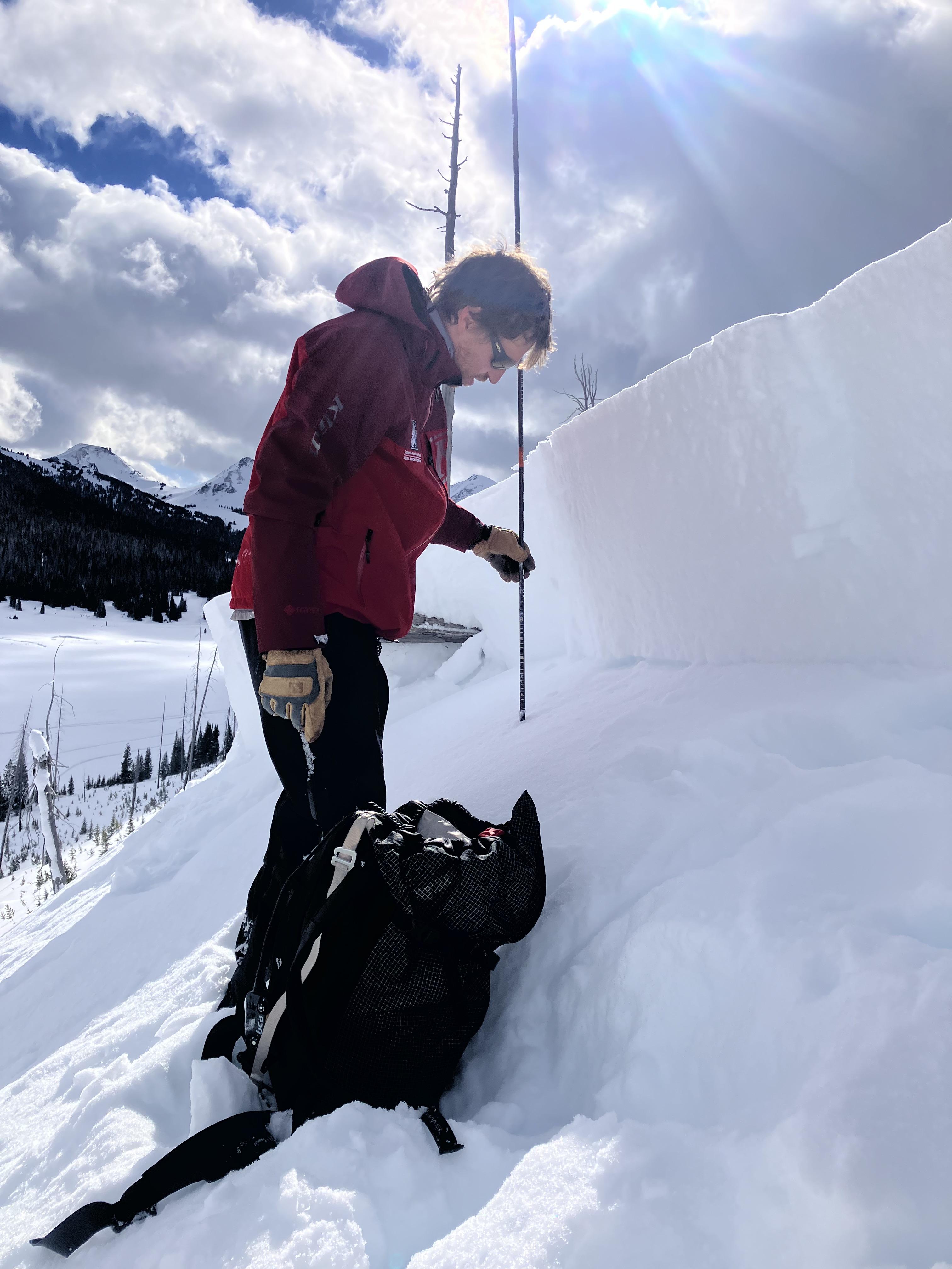
Near Cooke City on 4/19 skiers triggered a dry loose avalanche and a small wind slab avalanche. The wind slab broke in a drifted pocket near the base of cliffs, 3-6" deep x 10' wide. Northeast aspect, 10,200'. Photo: GNFAC
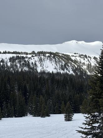
Trip Planning for Cooke City Area

Primary Problem: Wind Slab
Bottom Line: Avalanche conditions are complicated by a mix of winter and spring weather this week. Rain and snow fell on mountain snowpacks, with the most significant precipitation in the Bridger Range for the start of the week. The more new snow there is, the more likely you are to encounter avalanches and the larger their potential size. If your travel plans take you to slopes steeper than 30 degrees, assess how the new and wind-drifted snow is bonding to the old snow surface by watching for clear signs of instability, such as avalanches and shooting cracks. If rain fell on the snowpack and as temperatures warm, breaking through an unsupportable and slushy snowpack, seeing pinwheels of wet snow and small wet slides are indicators of wet snow instability.Past 5 Days
Sat Apr 19

Moderate
Moderate
Sun Apr 20

Low
Low
Mon Apr 21

None
None
Fri Apr 25
None
None
Mon Apr 28
None
None
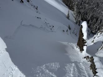
Relevant Avalanche Activity
Cooke City
Sheep Mountain
small wind slab and dry loose slides
Sheep Mountain
SS-AS-R1-D1-I
Elevation: 10,200
Aspect: NE
Coordinates: 45.0722, -109.9280
Caught: 0 ; Buried: 0
More Avalanche Details
SS-AS-R1-D1-I
Elevation: 10,200
Aspect: NE
Coordinates: 45.0722, -109.9280
Caught: 0 ; Buried: 0
Near Cooke City on 4/19 skiers triggered a dry loose avalanche and a small wind slab avalanche. The wind slab broke in a drifted pocket near the base of cliffs, 3-6" deep x 10' wide. Northeast aspect, 10,200'.
More Avalanche Details
Cooke City
COOKE CITY
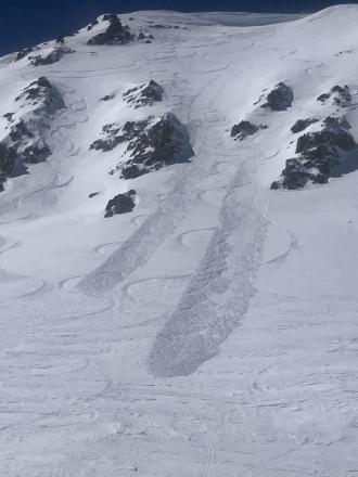
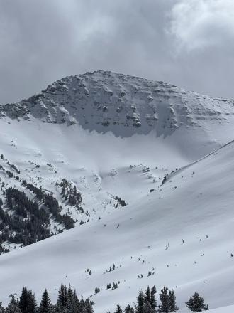
Wind Slab Activity in Cooke City
COOKE CITY
SS-N-R2-D2-I
Coordinates: 45.0202, -109.9380
Caught: 0 ; Buried: 0
More Avalanche Details
SS-N-R2-D2-I
Coordinates: 45.0202, -109.9380
Caught: 0 ; Buried: 0
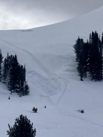
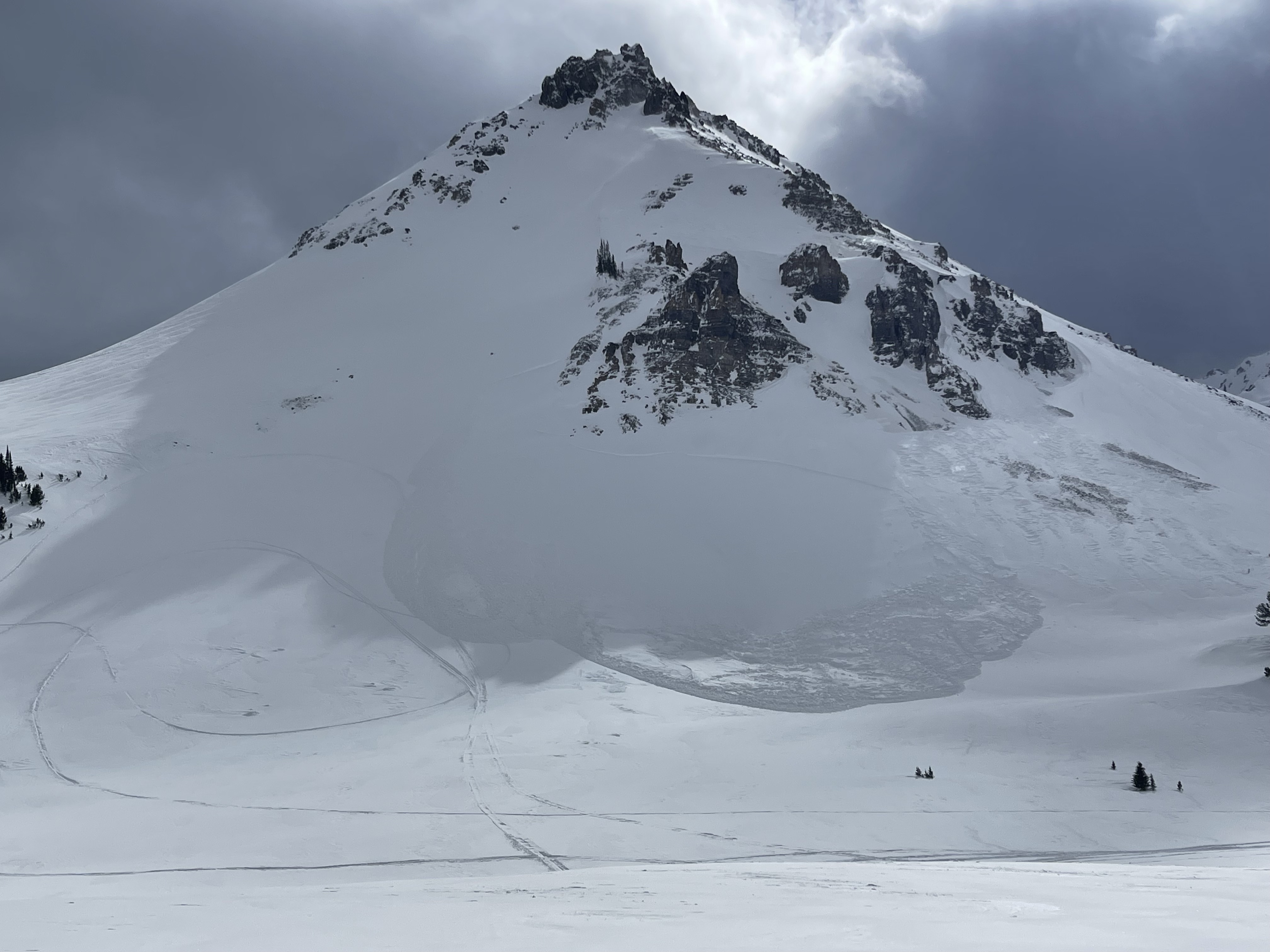
I rode the motorized zone and noticed natural wind slab avalanches running pretty far on: East Henderson, SE Scotch Bonnet, East Miller, NE Crown Butte. D1.5-2.0
Loose wet debris from yesterday were also present in many places.
More Avalanche Details
Cooke City
Hayden Creek
wet loose avalanches south of Cooke
Hayden Creek
WL-N-D1
Coordinates: 44.9952, -109.9080
Caught: 0 ; Buried: 0
More Avalanche Details
WL-N-D1
Coordinates: 44.9952, -109.9080
Caught: 0 ; Buried: 0
Today I was skiing in East Hayden Creek. I witnessed a cornice fall around 1230pm. Also I triggered multiple wet loose avalanches on several aspects including a north facing slope 9400 ft. None bigger than D1
More Avalanche Details
Relevant Photos
Displaying 1 - 40
-
-
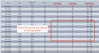
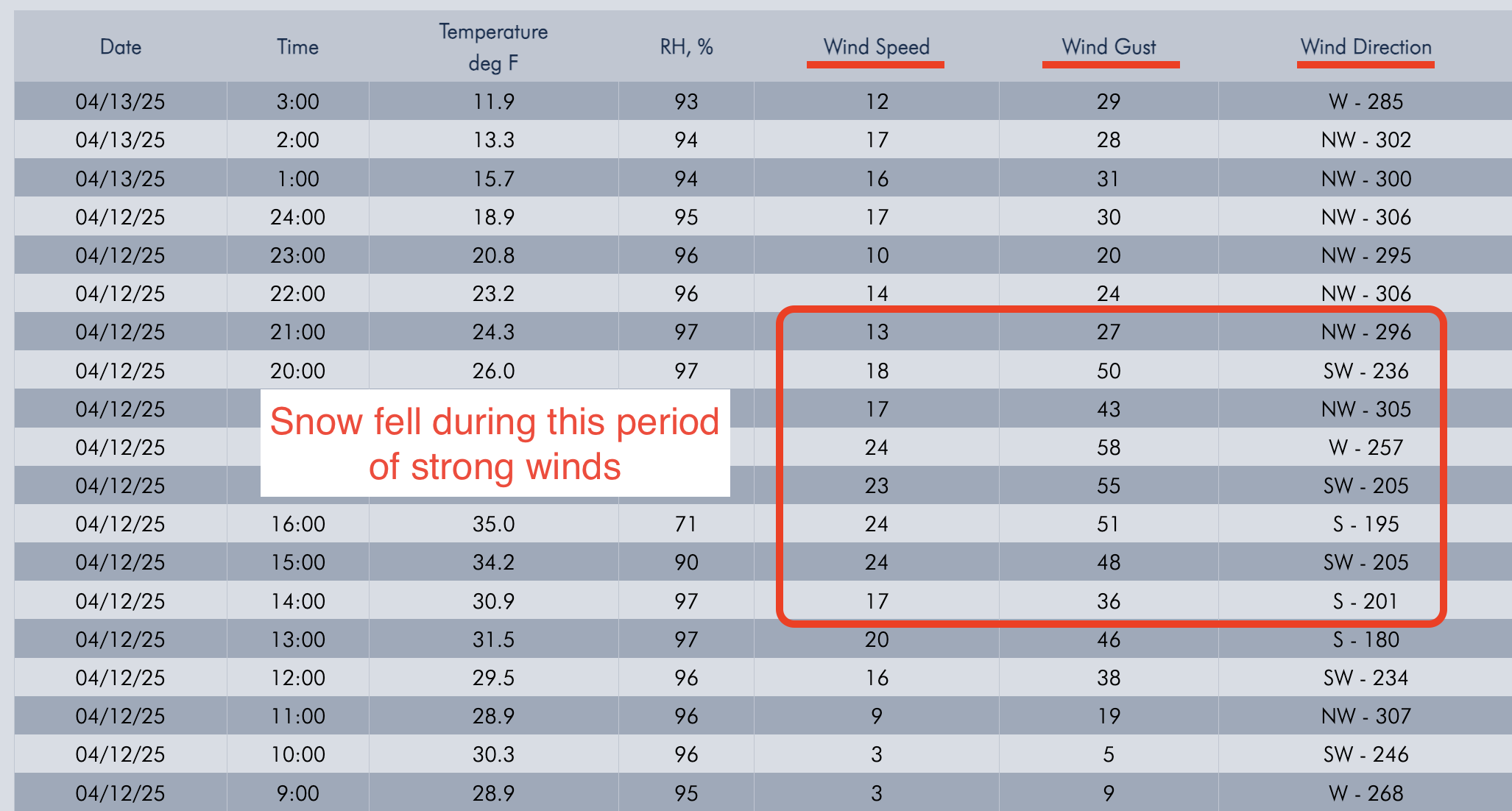
Screenshot of winds from Lulu Pass wind station during the storm.
-

Old wind slab, South East on Scotch Bonnet. Photo: Anonymous
-
Apr 7 A Skier triggered a 6”x20’ wide wind slab on a N aspect at 9,800’.
-
Apr 7 A Skier triggered a 6”x20’ wide wind slab on a N aspect at 9,800’.
-

On Apr 7 Skiers triggered D1-D1.5 wet loose on SE aspect at 10,000’.
-
Apr 5 Wind slabs were still reactive. We triggered 3 small, 3-8" deep x 5-15' wide, hard wind (1F+) slabs on convex test slopes well below the main ridgelines. 9,800', NE aspects. Photo: GNFAC
-
Apr 5 Wind slabs were still reactive. We triggered 3 small, 3-8" deep x 5-15' wide, hard wind (1F+) slabs on convex test slopes well below the main ridgelines. 9,800', NE aspects. Also triggered one softer (4F) wind slab just below the high ridgeline, 10,200', NE aspect. 10-15' wide x 6-8" deep (Pictured). Photo: GNFAC
-
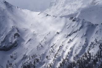
Apr 5 We saw a couple 3-6" deep natural wind slab avalanches and a few dry loose slides that looked to have happened within the last 24 hours. Photo: GNFAC
-
Wind slab near Cooke City from yesterday. Intentionally triggered. North aspect, 10,100'. 1' deep, 20' wide. Photo: B Fredlund
-

Skier took a left turn under cornices to scrub speed and released a 6-10" windslab 40' wide which ran 10' at most. Super soft and easy to ski through. Photo: J Lee
-
From email: "Ski touring near Cooke City today we intentionally triggered a storm slab/ wind slab on a steep north aspect around 9600'. It was about 6" deep, and 30' wide." Photo: B Fredlund
-
Today we noticed these natural small wind slabs on Mt Henderson. Photo: J Mundt
-

Understanding Avalanche Safety Preparedness – 5-Minute Survey for Motorized Users
We need your input! Eastern Oregon University is conducting a survey to better understand avalanche safety preparedness among motorized backcountry users like you. Your feedback will help us learn more about who is purchasing and practicing with avalanche rescue gear (beacon, probe, shovel) and participating in avalanche education—and why some riders aren’t. The survey is confidential and anonymous.
Your feedback is invaluable in improving avalanche education and awareness. Please take a moment to share your experience and help us make a difference.
https://eoustmhs.qualtrics.com/jfe/form/SV_3L8QKAuZzcxJBLo
Thank you for your time and for being a part of this important effort!
-
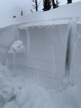
As we rode, we dug a few snowpits looking for the weak layer that we found yesterday buried about 2 feet deep. While we were able to find this layer, we only got propagation in one of three tests (ECTP 26, E aspect, 9070'). Photo: GNFAC
-
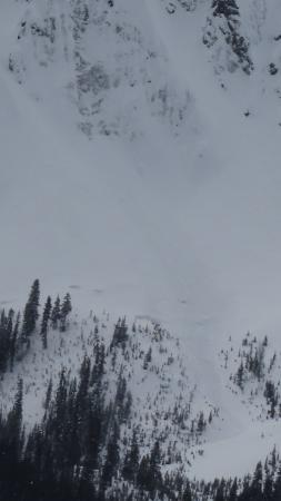
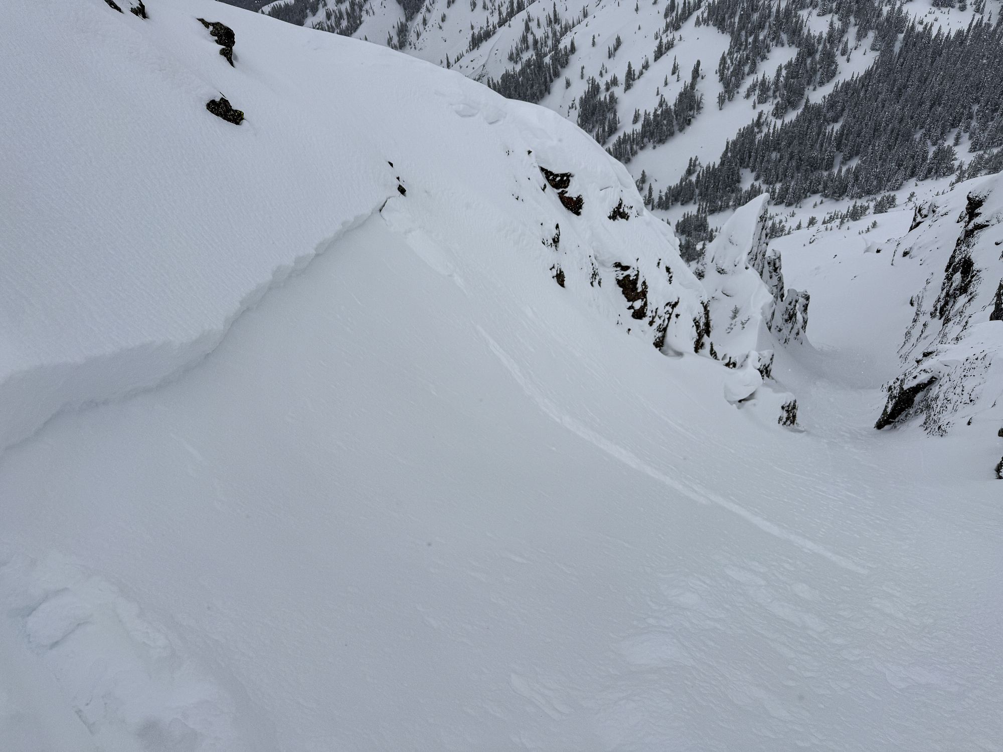
We noted one avalanche on the Fin that likely occurred yesterday or early this morning from a wind slab or cornice fall. Photo: GNFAC
-
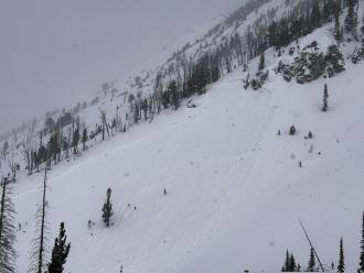
Photo of a recent natural avalanche north of Cooke City, observed today (3/23/25). A S, SE aspect in Sheep Creek at about 9000'. Photo: B Fredlund
-

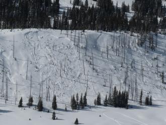
Today we saw a D2 slab avalanche at Goose Lake, E facing, 10800 ft. We estimate this avalanche to have ran in the early hours of 3/17. Photo: BPG
-
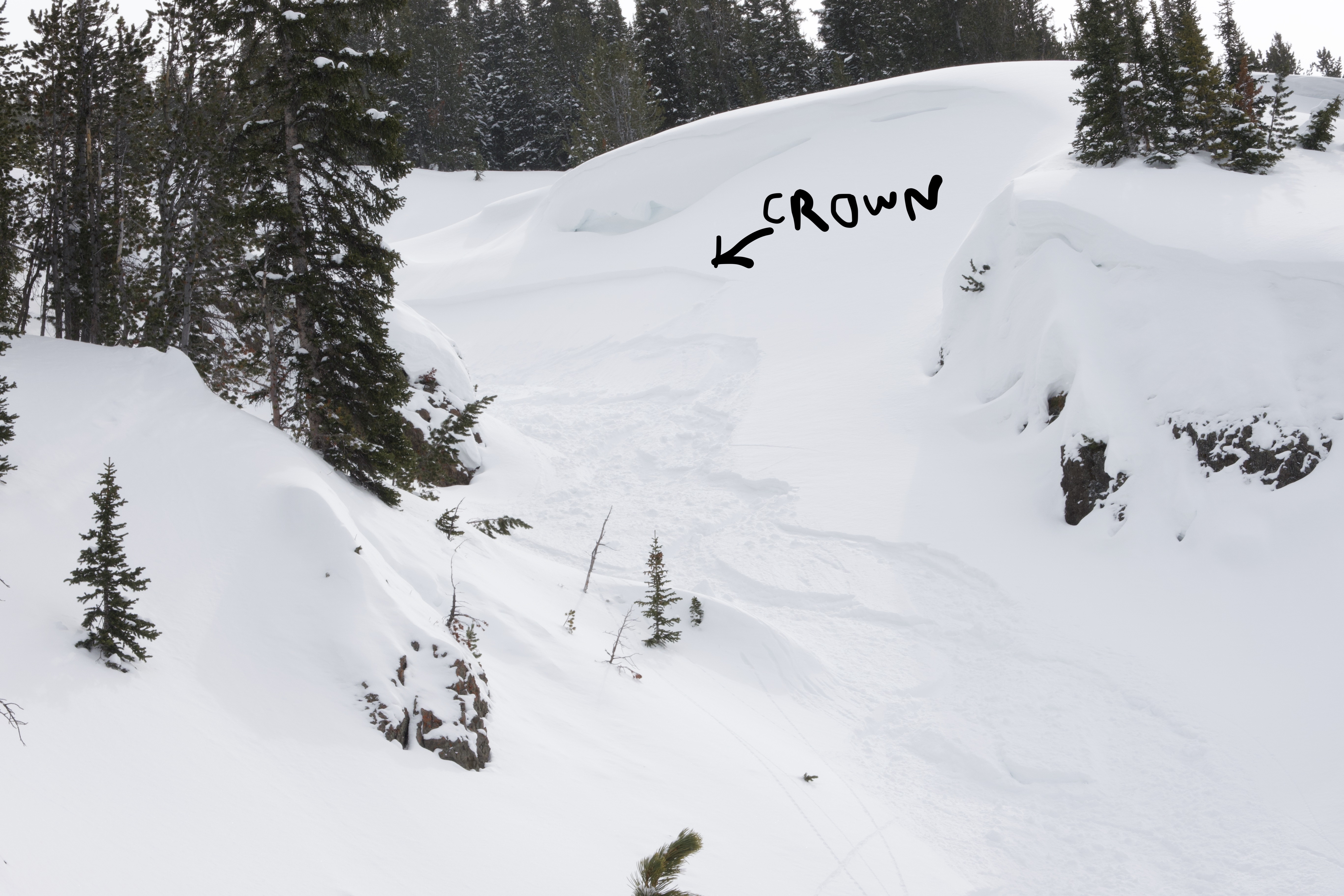
No fresh avalanche activity observed. Attached is a photo of the only sign of a recent avalanche we could find. (an old crown on an East aspect at 9600'). Photo: B Fredlund
-
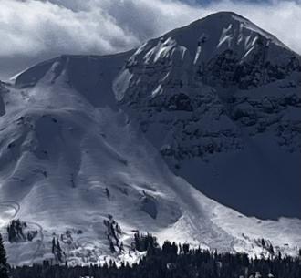
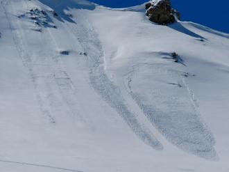
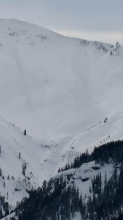
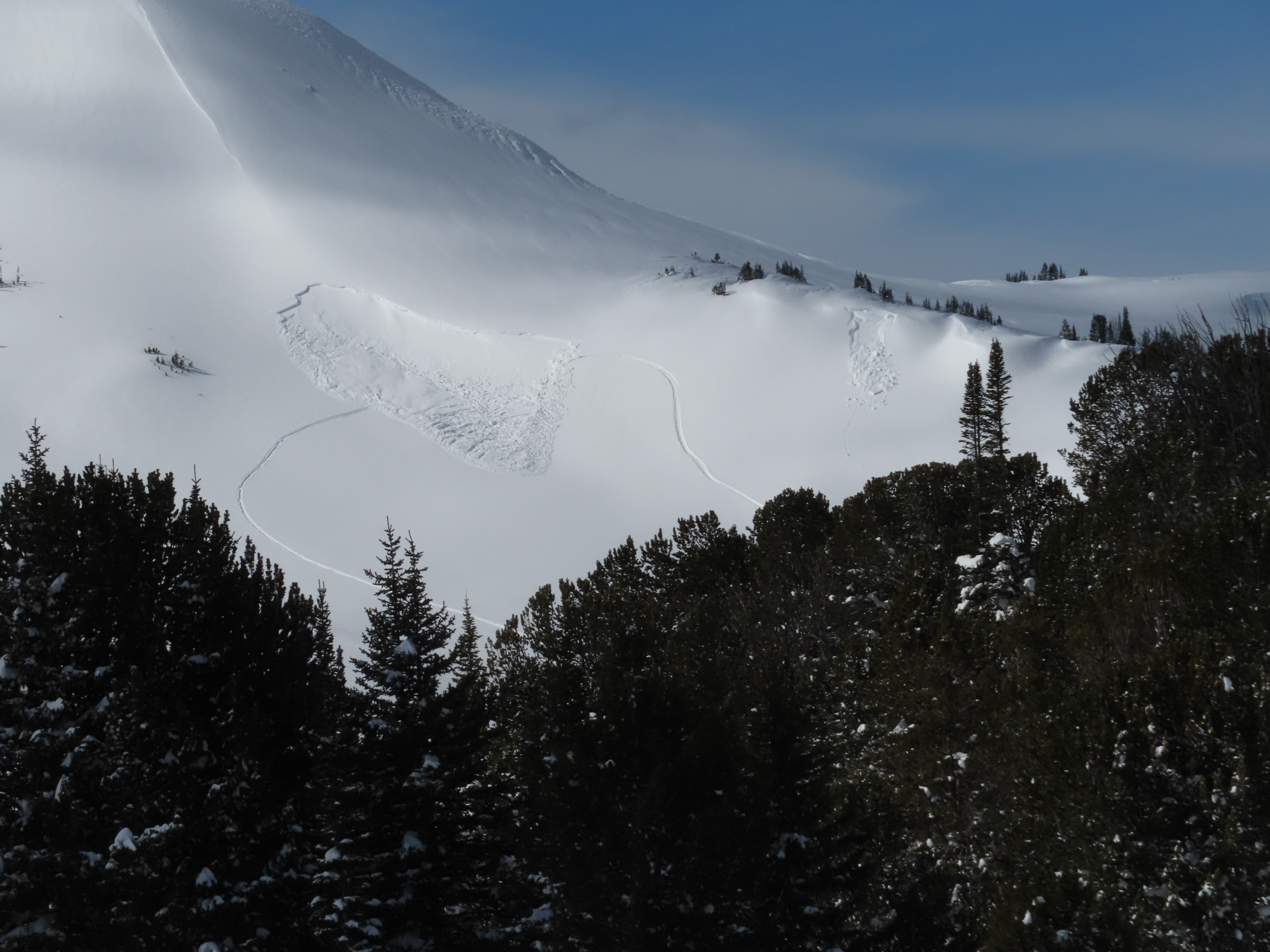
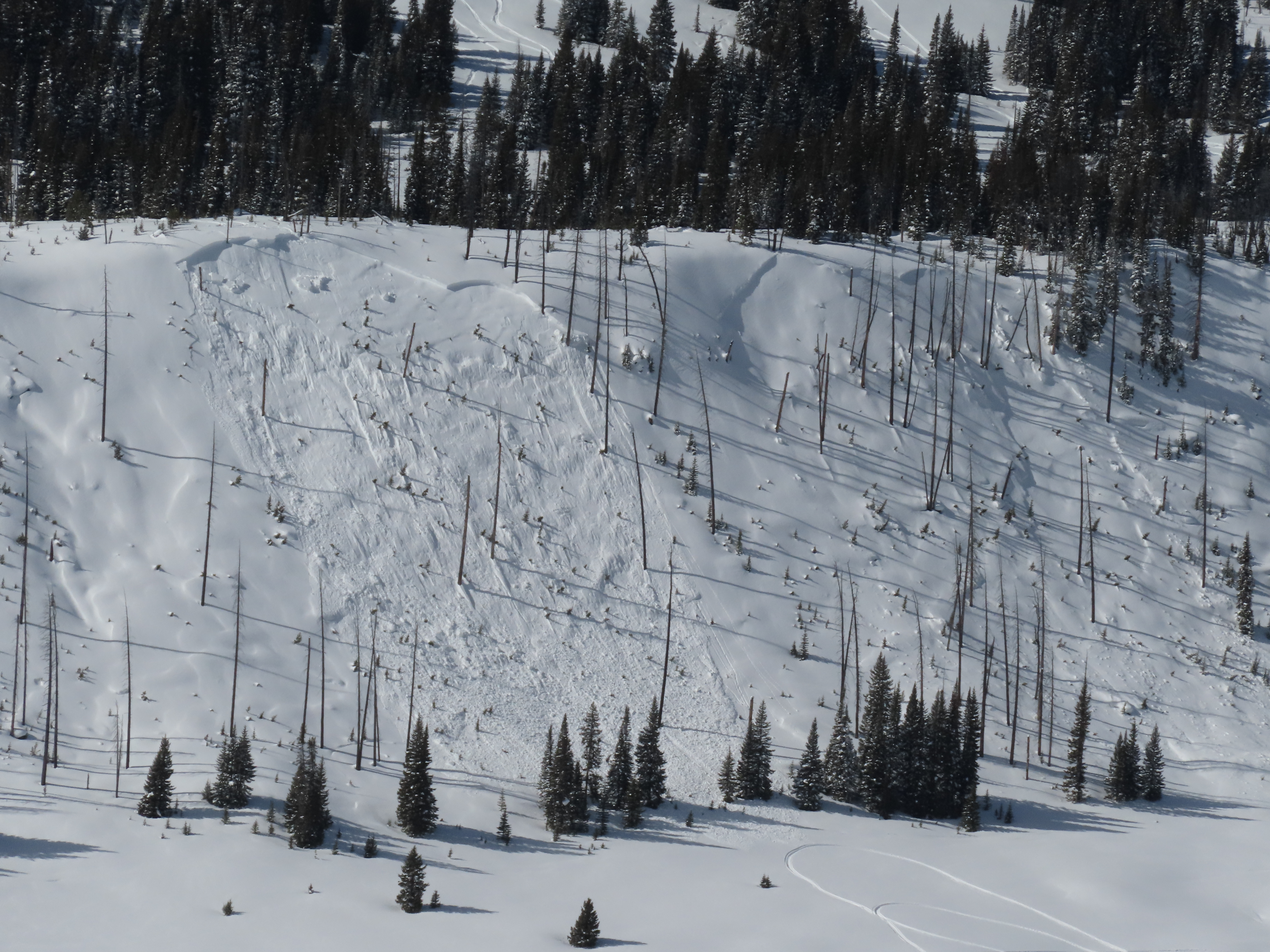
Avalanche on the SE face of Scotch Bonnet in Tragenic Bowl and one on the NE face of Wolverine. They both broke 2-4’ deep. The avalanche on Wolverine slide aprx 1500’. Both were in wind loaded areas at upper elevations. Photo: BPG
-
"Today I triggered a D1 dry loose avalanche on a E facing 35 degree slope, 9300 ft on Mt Henderson. The new snow is very low density and is not bonding well to the old interface. I also observed some more dry loose activity/small wind slabs on Sheep Mt, NE facing, 10400 ft."
-
Near Cooke City on Mar 14 there was 6" of new snow and wind was calm, even along the ridge near regularly wind-loaded slopes, and there was no snow blowing off ridgelines. The photo shows a slope that normally receives a lot of wind effect, but the new snow is unaffected indicating the wind has been calm. Photo: GNFAC
-
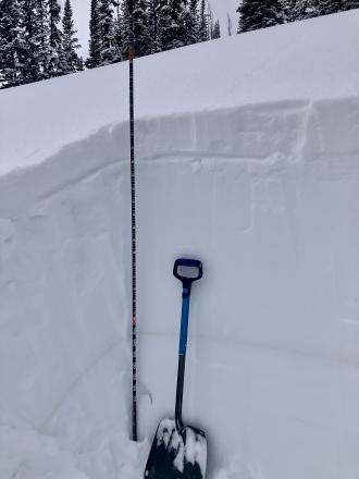
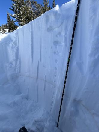
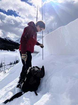
Dug a pit on a northeast facing slope, 9300' (profile and pic attached) near Cooke City. Snow depth was 7-8 feet. 6" of new snow was right side up. Below the new snow was a soft (1F-) melt-freeze crust with soft decomposing and slightly faceted particles below. ECTN13 broke below the crust. Below that the snowpack was 1F to P+ hard and lacked weak layers. The Feb 4 dirt layer was clearly visible. Photo: GNFAC
-
Today I observed multiple small wind slab avalanches off Woody Ridge. NE and E facing, 10000 ft. Max size D1. Photo: BPG
-
Today I observed multiple small wind slab avalanches off Woody Ridge. NE and E facing, 10000 ft. Max size D1. Photo: BPG
-
Many dry loose slides on Cooke Peak in Hayden Creek. Photo: BPG
-
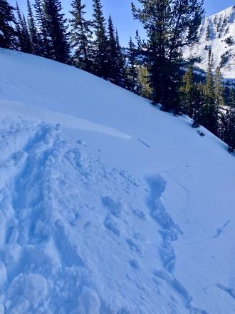
We also witnessed a falling cornice today that washed some snow through rocks. Be aware of what's above you.
-
Above Goose Creek -hard, dense, strong, and deep snow. Facets from late January are 1F+ hardness
-

Fresh wind slab avalanche seen this afternoon, possibly rider triggered. Photo: N. Meyers
-
On Feb 24 we saw at least 3 rider triggered wind slabs, 4-5 natural wind slab avalanches, and a couple large cornice falls. Strong wid had affected almost every piece of terrain, scouring some slopes, loading others, just stiffening the slab in many areas, and forming fresh drifts on every convex roll and along the edges of trails. Riding was still soft and fairly consistent in many areas. Photo GNFAC
-
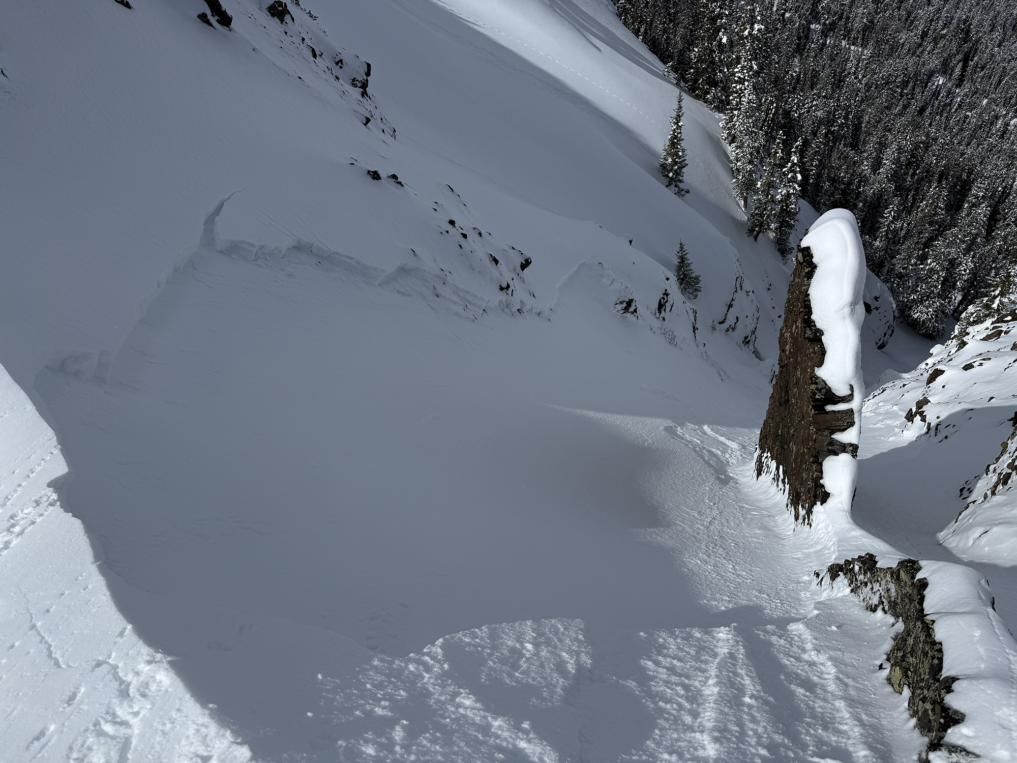
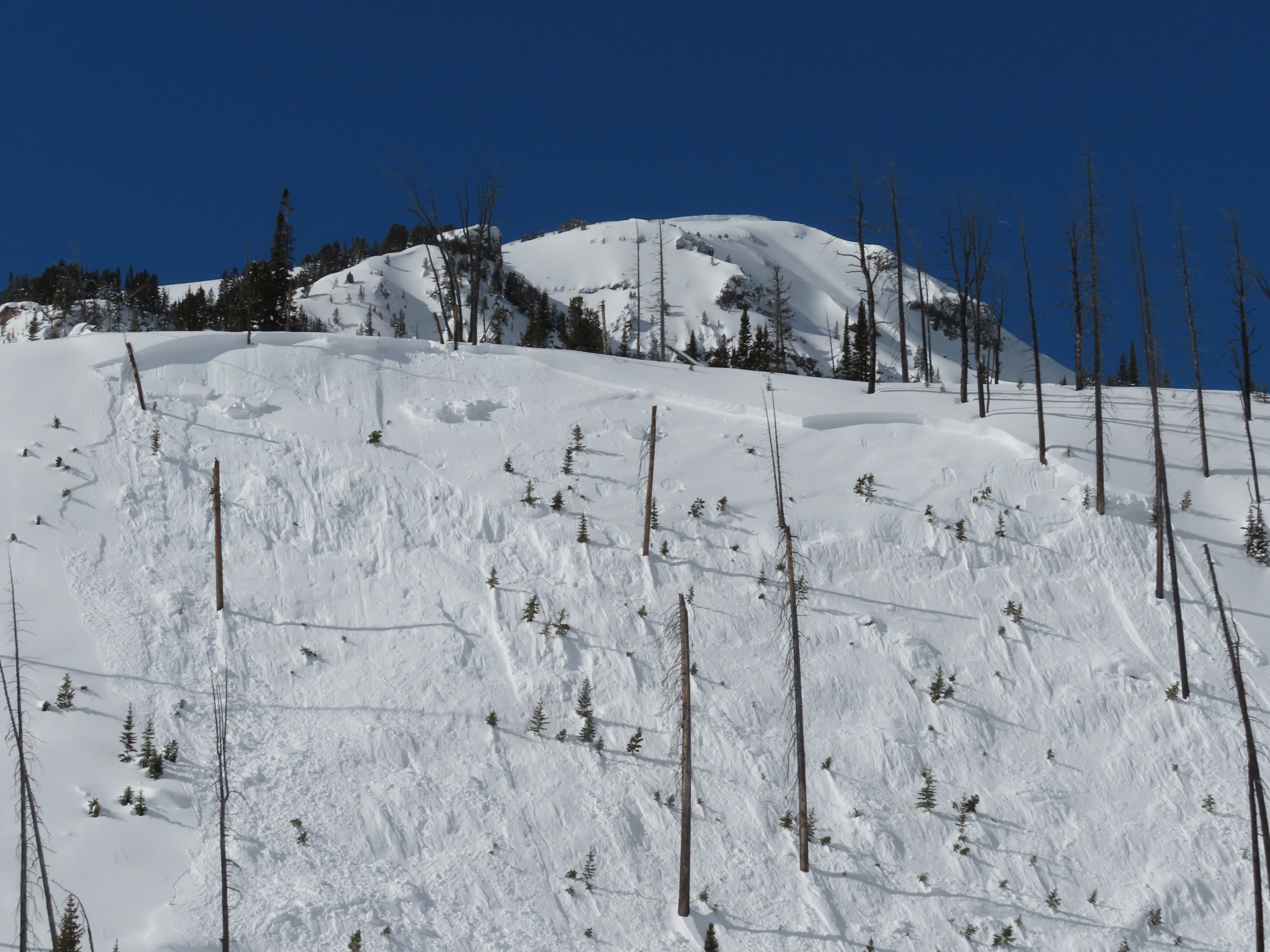
While looking for a recent avalanche from the flat bench above we triggered a similar sized slide directly adjacent to the previous slide. They broke on weak layers of facets and surface hoar that formed at the end of January. 2-3 feet deep and 150-200' wide. Photo: GNFAC
-
While looking for a recent avalanche from the flat bench above we triggered a similar sized slide directly adjacent to the previous slide. They broke on weak layers of facets and surface hoar that formed at the end of January. 2-3 feet deep and 150-200' wide. Observing the snowpack that caused the avalanche. Photo: GNFAC
-

While looking for a recent avalanche from the flat bench above we triggered a similar sized slide directly adjacent to the previous slide. They broke on weak layers of facets and surface hoar that formed at the end of January. 2-3 feet deep and 150-200' wide. Photo: GNFAC
-
While looking for a recent avalanche from the flat bench above we triggered a similar sized slide directly adjacent to the previous slide. They broke on weak layers of facets and surface hoar that formed at the end of January. 2-3 feet deep and 150-200' wide. Photo: GNFAC
-

While looking for a recent avalanche from the flat bench above we triggered a similar sized slide directly adjacent to the previous slide. They broke on weak layers of facets and surface hoar that formed at the end of January. 2-3 feet deep and 150-200' wide. Photo: GNFAC


Videos- Cooke City Area
WebCams
Soda Butte Lodge, looking West
Soda Butte Lodge, looking East


Weather Stations- Cooke City Area
Weather Forecast Cooke City Area
Extended Forecast for2 Miles NNE Cooke City MT
This Afternoon

High: 45 °F
Chance
Rain/SnowTonight
Low: 27 °F
Rain/Snow
then Snow
Showers
LikelyWednesday

High: 42 °F
Chance Snow
ShowersWednesday Night
Low: 24 °F
Slight Chance
Snow Showers
then Mostly
ClearThursday

High: 47 °F
Mostly Sunny
Thursday Night

Low: 26 °F
Mostly Clear
Friday

High: 56 °F
Sunny
Friday Night

Low: 33 °F
Clear
Saturday
High: 59 °F
Sunny
The Last Word
Thank you for another successful season. Our success is directly related to support from our community and the Forest Service. Thanks to the readers of the forecast, everyone that sent in observations, took an avalanche class, or donated money, time or gear. We will issue conditions updates on Mondays and Fridays through April.
GENERAL SPRING SNOWPACK AND TRAVEL ADVICE
Spring weather can be highly variable and create a mix of avalanche problems. Snow conditions and stability can change drastically from day to day or hour to hour. Anticipate rapid change and plan accordingly. Abundant snowfall over the winter with more spring snow to come makes avalanches possible into summer.
NEW SNOW AND WIND LOADED SLOPES
Spring storms are notorious for depositing heavy amounts of snow in the mountains. Even with a deep and generally stable snowpack throughout the advisory area, heavy and rapid loads of new snow will decrease stability. The main problems to look out for are avalanches breaking within the new snow, wind slabs, and loose snow avalanches. The likelihood of triggering an avalanche spikes during and immediately after snowstorms. New snow instabilities tend to stabilize quickly, but it’s a good idea to give fresh snow a day to adjust before hitting big terrain. New snow instabilities can be challenging to assess, and spring storms bond to old snow differently across aspects and elevations. Conservative terrain selection is essential during and immediately following storms. Avoid wind-loaded slopes and slopes steeper than 35 degrees for 24-48 hours after new snow and wind.
New snow can quickly change from dry to wet on a spring day, and stability can decrease rapidly with above freezing temperatures or brief sunshine. New snow may bond well early in the morning and then easily slide later. Wet loose slides are likely during the first above freezing temperatures or sunshine immediately after a storm. Anticipate changes in snow stability as you change aspect or elevation and over the course of the day. An early start is always an advantage. Be ready to change plans or move to safer terrain at the first signs of decreasing stability.
WET SNOW AVALANCHES
Spring and wet snow avalanches go hand-in-hand. Above freezing temperatures, rain, and/or intense sunshine cause the snow to become wet and weak and make wet avalanches easy to trigger or release naturally. Conditions tend to become most unstable when temperatures stay above freezing for multiple days and nights in a row. Avoid steep terrain, and be aware of the potential for natural wet avalanches in steep terrain above you, if you see:
- Heavy rain,
- Above freezing temperatures for more than 24 hours,
- Natural wet avalanches,
- Rollerballs or pinwheels indicating a moist or wet snow surface,
- Or if you sink to your boot top in wet snow.
In general, if the snow surface freezes solid overnight, the snowpack will be stable in the morning and stability will decrease through the day as snow warms up. The snow surface hardness, rate of warming, duration of sunshine, aspect and elevation determine how fast stability will decrease through the day. Be aware that sunny aspects may have a wet snow avalanche danger while shadier slopes still have a dry snow avalanche danger. Getting off of steep slopes should be considered when, or before, the above signs of instability are present. Wet snow avalanches, whether loose snow or slabs, can be powerful, destructive and very dangerous. Conservative terrain choices, starting early in the day, and careful observations can keep you safe. See Alex’s recent video, and this article for more spring travel advice.
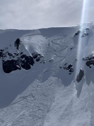
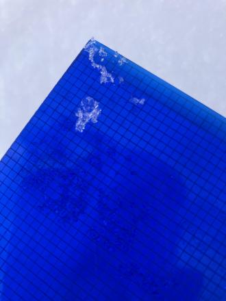
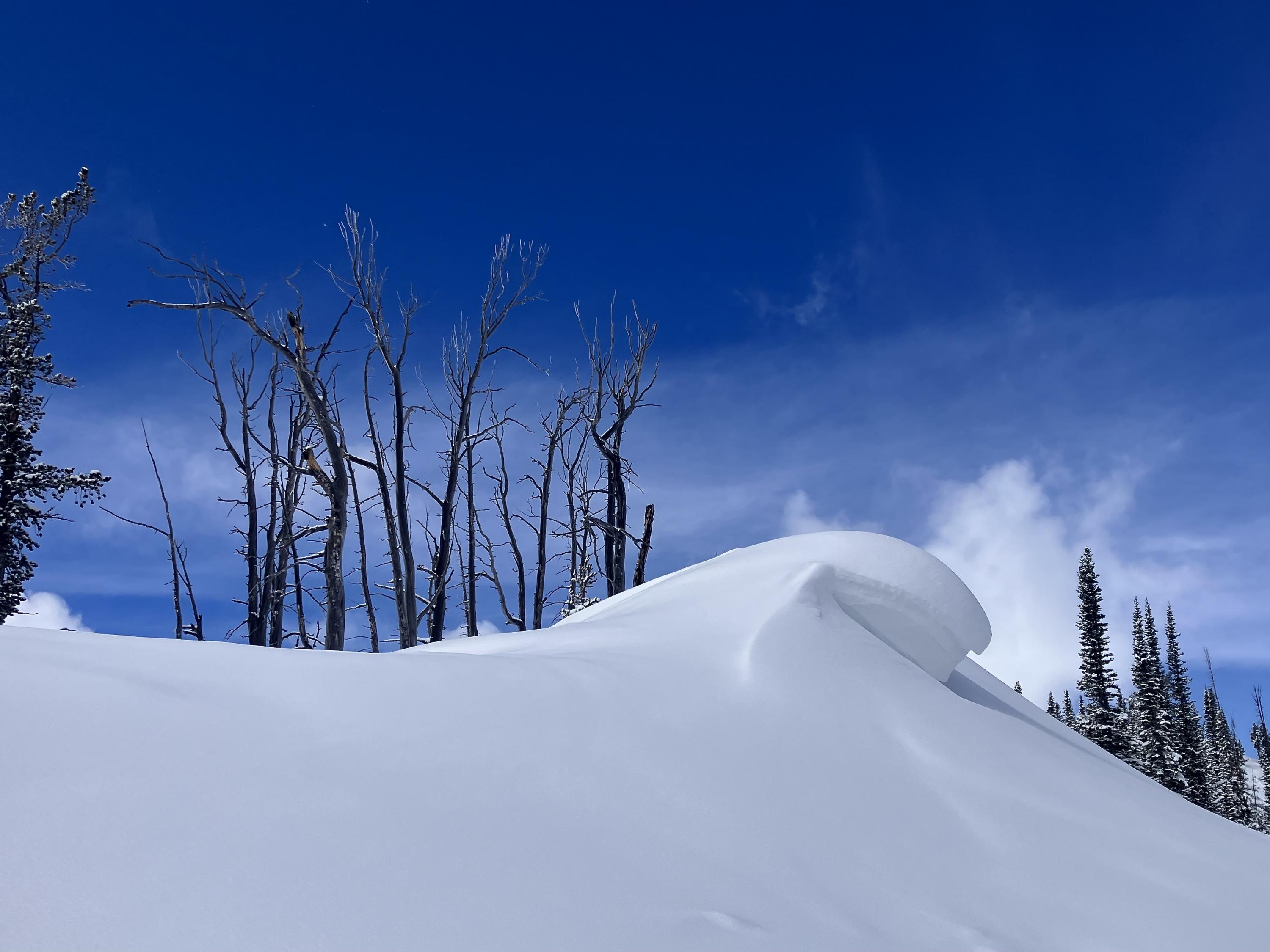
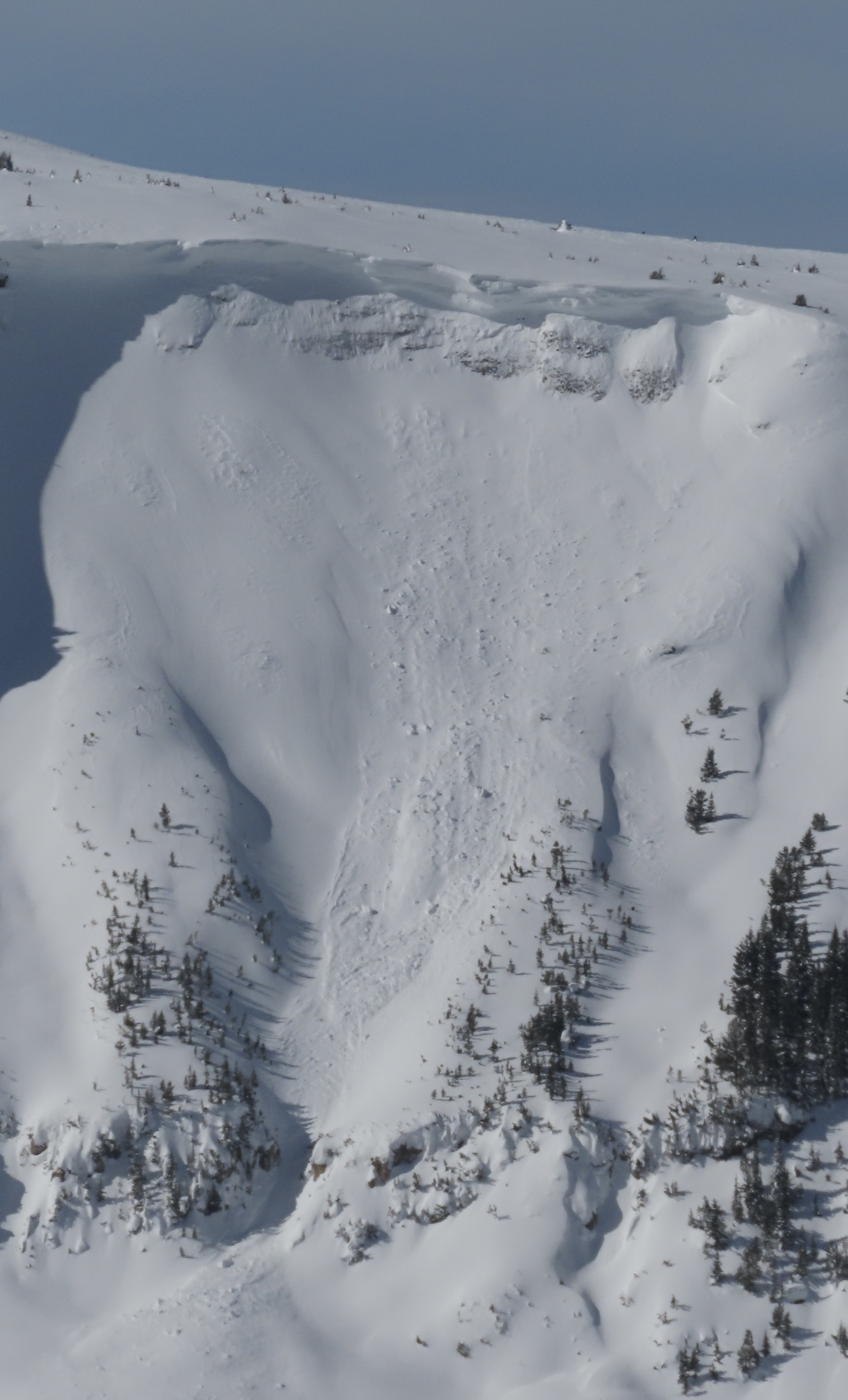
CORNICES
Cornices along ridgelines are massive and can break under the weight of a person (photo). Prolonged above freezing temperatures and rain make them weaker and possible to break naturally. They can break off suddenly and farther back than one might expect. Cornice falls can also entrain large amounts of loose snow or trigger slab avalanches. Stay far back from the edge of ridgelines and minimize exposure to slopes directly below cornices. Regardless of whether a cornice triggers a slide or not, a falling cornice is dangerous to anyone in its path.
DISCLAIMER
It does not matter if new snow falls or not, avalanches will continue to occur until the existing snowpack is mostly gone. Always assess the slope you plan to ride with diligence and safety in mind. Do not let your guard down. Travel with a partner, carry rescue gear and only expose one person at a time in avalanche terrain.
Have a safe and enjoyable spring and summer!
Mark, Alex, Ian and Dave
For more spring travel advice see this article from our GNFAC forecaster blog.